Chart 5D, ready to print
Nautical chart no. 5/D of the Italian Navy Hydrographic Institute (Istituto Idrografico della Marina) covers the sea between Elba, Pianosa, Giglio and Monte Argentario. In the Italian boating license exam (up to 12 miles), the chart-work test is done on one of its three sectors, printed in A3. Here are all three as PDF files, the same ones published for candidates on the Portale dell’Automobilista.
Print them on A3 paper at 100% (actual size, not “fit to page”).
Sheet 2
North-West, portrait
Western Elba and Pianosa
A3 PDF · 0.3 MB
Download the PDF: Sheet 2 · North-West, portrait
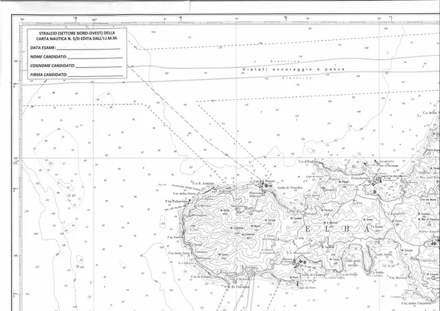
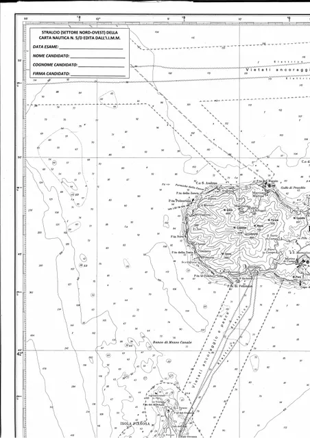
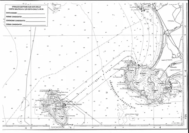
Questa rappresentazione non è una carta nautica e non va usata per la navigazione.
In English: this representation is not a nautical chart and must not be used for navigation.
Practice on the same chart
The 50 official chart-work exercises use these three sectors. In Rotta you learn them with interactive lessons and work them on chart 5D, with a guided solution and the exam tolerances. With “Compasso alla mano” you move the dividers on screen and Rotta corrects you on the spot. Chart work is in Rotta Completa and Rotta Carteggio. The app is in Italian.